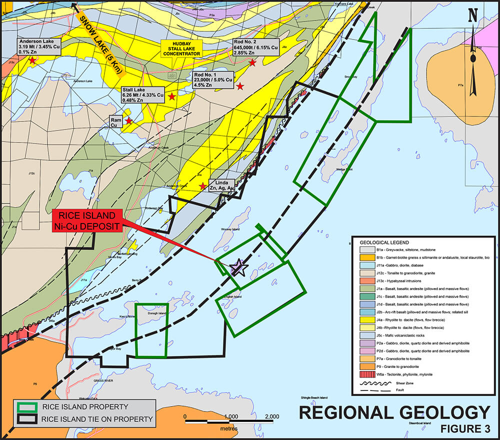
The 2,611 hectares property contains the flagship Ni-Cu-Co Rice Island deposit is located in the Snow Lake-Flin Flon greenstone belt, 5 kilometres from Hudbay’s Snow Lake concentrator and associated mining infrastructure.
The Rice Island mineral resource occurs at the southwest end of Rice Island where mineralization occurs at the basal contact of a northeast-striking, steeply plunging gabbroic intrusion and underlying sedimentary rocks. Classic orthomagmantic Ni-Cu-Co mineralization was earlier found by Inco Ltd. at the Main Zone, at the basal contact of the intrusion during the period 1949 to 1967. Drilling by Wolfden has confirmed the grade and nature of Ni-Cu-Co mineralization of the Main Zone and was successful in discovering an underlying feeder zone or conduit (New Lower Zone) containing high-grade nickel sulphide mineralization. Wolfden’s future exploration efforts will be directed at additional drilling of the mineralizing system to enlarge the known mineral deposit and to find additional ones, within the framework of a dynamic system of magmatic fluid flow clearly exhibited by both limbs of the Main Zone and the Feeder Zone.
Property highlights
Property gallery


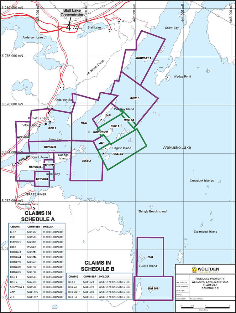
Land Tenure & History
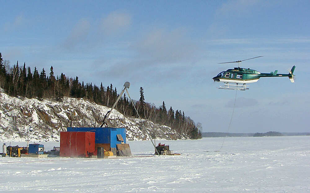
The 100%-owned Rice Island property comprising 2,611 hectares, was acquired by claim staking in May of 2015 (772 hectares) and by option agreement in September of 2016 (1,839 hectares). It is situated 10 kilometres south-southeast of the Town of Snow Lake in west-central Manitoba within the Snow Lake-Flin Flon greenstone belt. It is well located with respect to infrastructure including power, labour, supplies and mineral processing facilities situated in the nearby mining communities of Snow Lake and Flin Flon. Proximity to such infrastructure enables the Company to explore the property year-round and at reasonable cost.
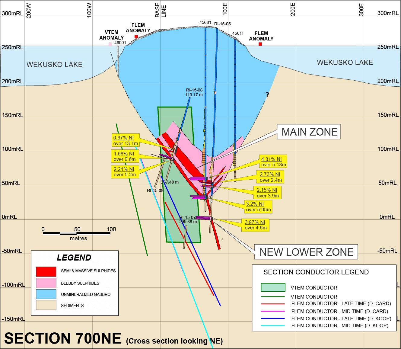
The Rice Island nickel-copper-cobalt deposit was explored by drill programs completed by Inco Ltd. (1949-1950 and 1967). Inco’s historic drilling included intercepts of 2.63% Ni, 0.98% Cu over 10.30 metres, 2.39% Ni, 1.24% Cu over 10.06 metres, 1.02% Ni, 0.85% Cu over 35.57 metres, 1.03% Ni, 0.50% Cu over 22.86 metres, 4.31% Ni, 1.28% Cu over 5.18 metres and 3.20% Ni, 1.23% Cu across 5.95 metres.
All of the documented drilling completed during the above periods utilized very small diameter drill core (AX) and the only surveying of drill holes employed during those times were dip tests, utilizing hydrochloric acid etching on test tubes. Upon review of all available data, it is clear that the Rice Island nickel-copper deposit and property have not been explored utilizing modern-day high-resolution techniques.
Location map
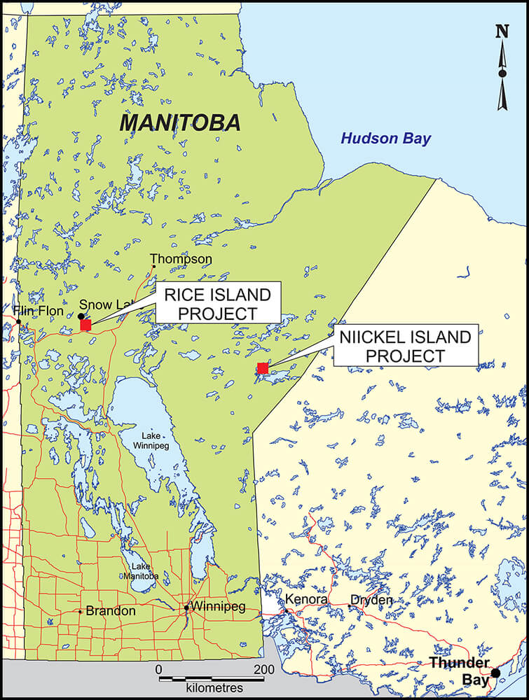
(Click image for larger view)
Claim sketch
(Click image for larger view)
Geology & Mineralization
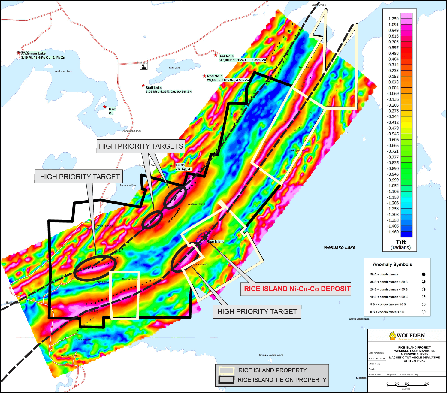
The property is located in the Proterozoic-age Snow Lake-Flin Flon greenstone belt of the Churchill Province, comprising part of the Canadian Shield. Regionally, lower-most felsic and mafic volcanic rocks of the Amisk group occur to the west of the Rice Island property and host several volcanogenic copper-zinc massive sulphide deposits situated nearby. Such deposits include Stall Lake (6.26 MT at 4.33% Cu, 0.48% Zn), Anderson Lake (3.19 MT at3.45% Cu, 0.10% Zn) and Rod No. 2 (0.65 MT at 6.15% Cu, 2.85% Zn). Further to the west-northwest within the same package of bi-modal volcanic rocks, is the currently producing Lalor volcanogenic massive sulphide deposit, owned by Hudbay Minerals (Reserves; 11.3 MT, 0.63% Cu, 7.8% Zn, 1.6 g/t Au, 23.8 g/t Ag, Resources; 3.6 MT, 2.4% Cu, 5.6% Zn, 3.5 g/t Au, 21.2 g/t Ag, Gold Zone: 6.2 Mt, 0.4% Cu, 0.47% Zn, 4.7 g/t Au, 31.5 g/t Ag).
Clastic sediments comprising greywacke and siltstone of the uppermost Amisk group overlie the bimodal volcanic suite and occur on the Rice Island property. These sediments are intruded by the Rice Island intrusion, comprising gabbro and ultramafic rocks that hosts the Rice Island nickel-copper-cobalt deposit. The Rice Island intrusion belongs to a syntectonic group of plutons that are spatially associated with and are earlier phases of large batholithic complexes in the Snow Lake area, including the Jackfish Lake pluton and the Tramping Lake pluton.
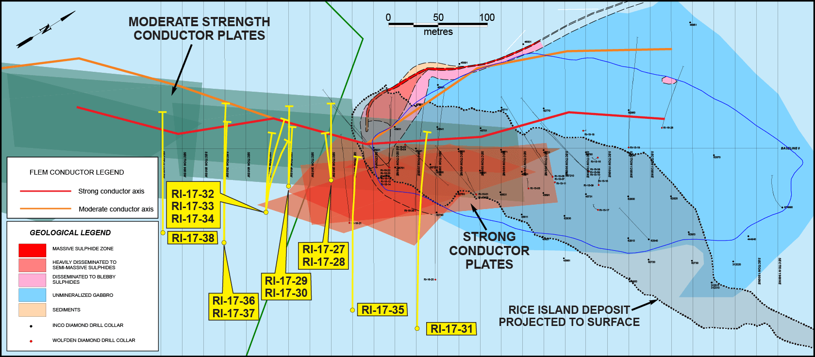
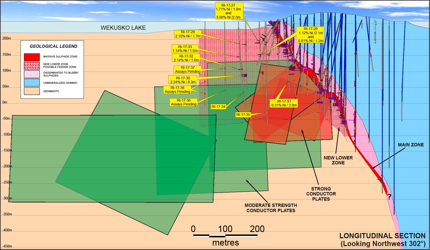
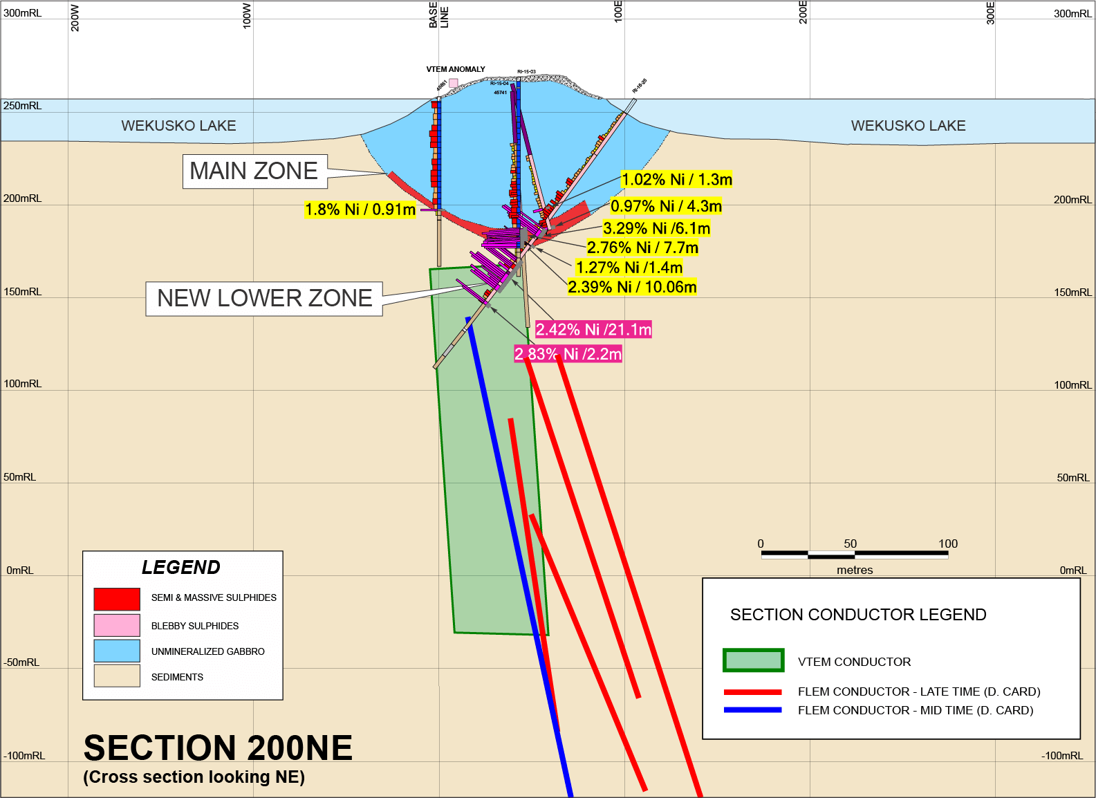
The Rice Island deposit has been delineated by diamond drilling over a 500-metre strike length and to a vertical depth of approximately 500 metres. It remains open along strike and potentially locally at depth below 400 metres. The Main Zone comprises semi-massive to massive pyrrhotite, pentlandite and chalcopyrite keel occurring at the base of the gabbro intrusion underlain by sedimentary rocks. The Main Zone is overlain by a zone of blebby or disseminated sulphides that are of lower tenor with respect to grade. A discovery made by Wolfden in 2015, known as the Lower Zone or Feeder Zone, is an underlying feeder dike or conduit returning locally high-grade values in nickel, copper and cobalt. This feeder zone mineralization enhances the mineral resource potential of the deposit as a whole. Following the conduit and path of fluid flow within the system may lead to other mineralized magma chambers.
Drill plan
(Click image for larger view)
Long section – wide
(Click image for larger view)
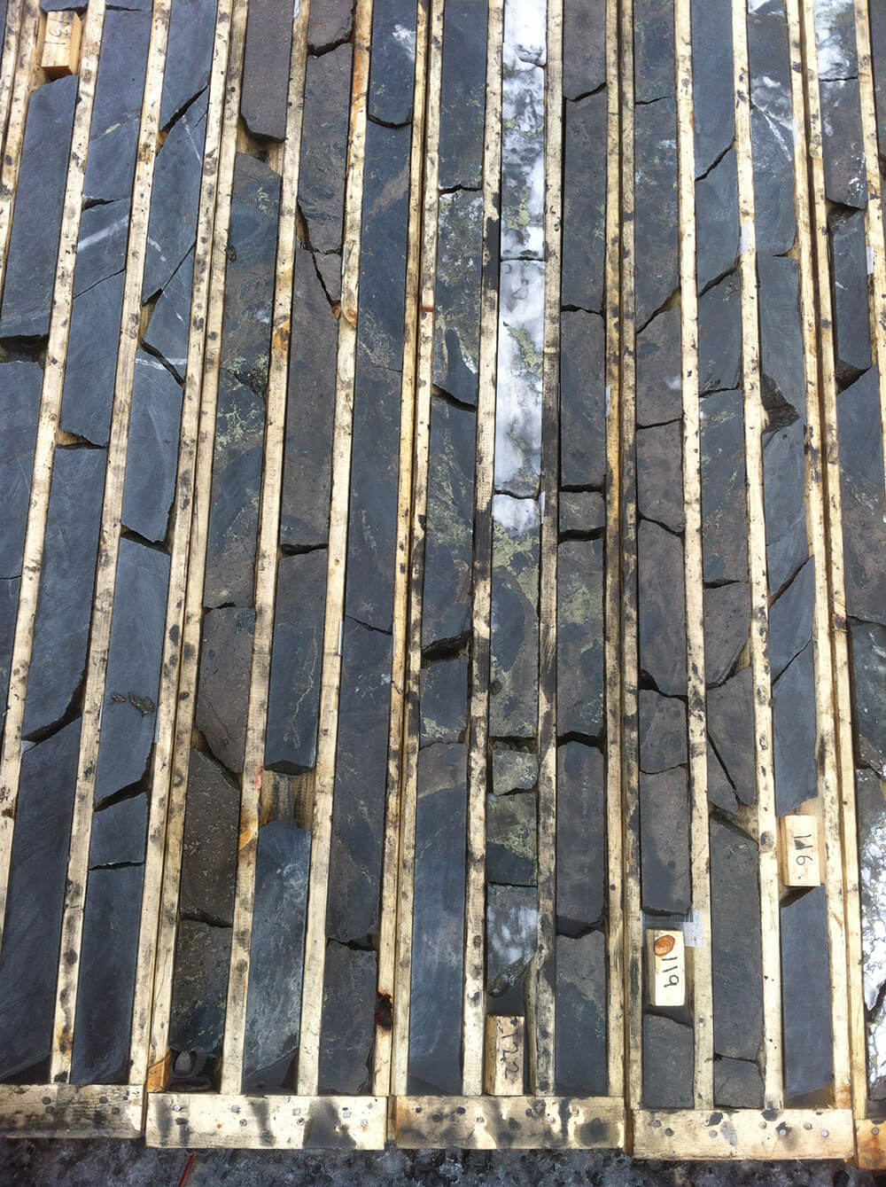
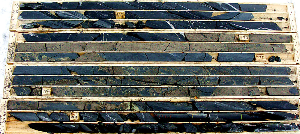
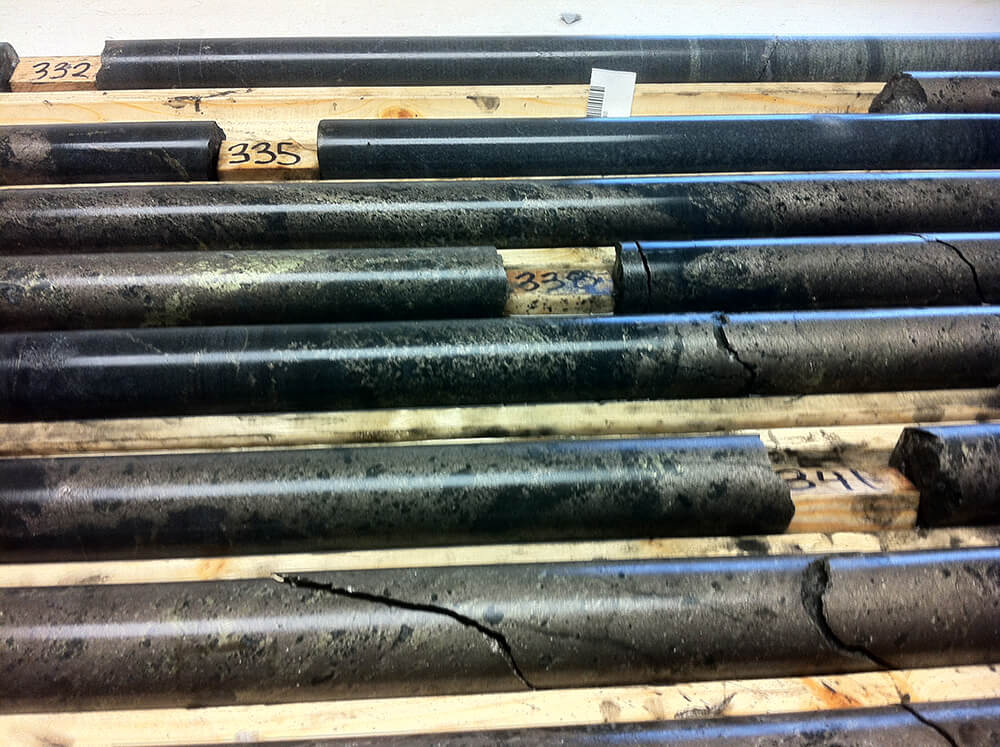
Core samples
(Click image for larger view)
Regional geography
(Click image for larger view)
Drilling results

(Click image for larger view)
Section 200NE
(Click image for larger view)
Section 700NE
(Click image for larger view)
Exploration Potential
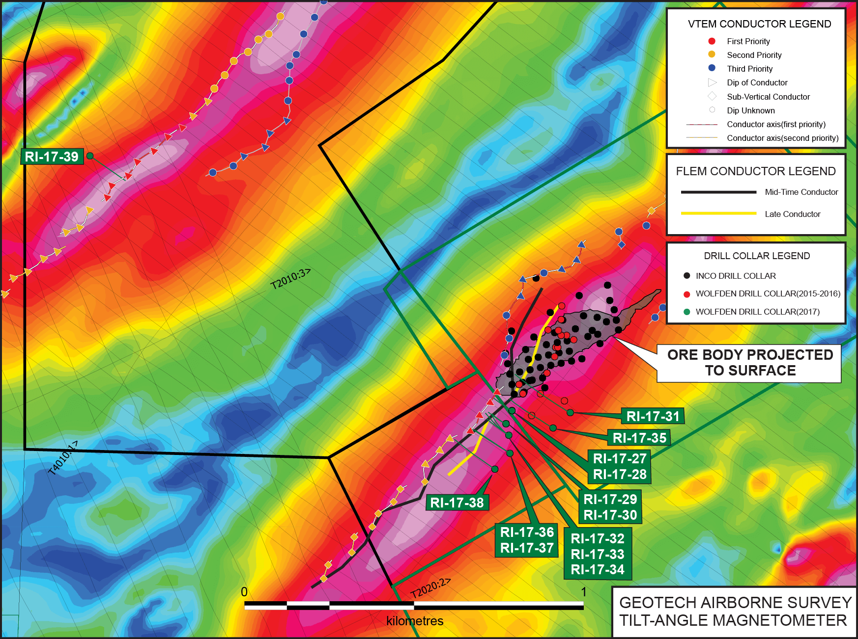
At the property scale, there are numerous exploration targets that are prospective for the discovery of additional magmatic nickel-copper-cobalt deposits. In general, the VTEM airborne geophysical survey delineated two (2) northeast to southwest-trending magnetic corridors. The Rice Island Ni-Cu-Co deposit is intimately associated with one of these corridors. These corridors or trends are also closely associated with conductors; the Rice Island Ni-Cu-Co deposit geophysical signature is comprised of a coincident magnetic high and a series of strong conductors. There are numerous other locales on the Rice Island property that have a similar geophysical signature as to that of the Rice Island deposit. Additional drilling is clearly warranted to test these target areas.
At the deposit scale, there is excellent potential for extending nickel-copper-cobalt mineralization to the southwest and northeast of the existing Rice Island deposit. The geophysical trend that typifies the Rice Island deposit (coincident magnetic high and moderate to strong conductors) continues for an additional 500 metres to the southwest of the outer limits of current drilling testing Rice Island mineralization. The Rice Island deposit is open-ended along strike to the northeast and may have local depth extension down plunge below 400 metres. The deepest hole drilled on the historic deposit intersected significant mineralization at a vertical depth of 500 metres and intersected 1.33% nickel over 3.78 metres. Additional drilling is clearly warranted to test for the continuation of mineralization.
Geotech Airborne survey tilt-angle magnetometer
(Click image for larger view)
Drilling results
(Click image for larger view)